DESPITE THE EFFORTSThe administration of President Donald Trump aimed to eliminate the idea of human-induced global warming by removing climate-related federal financial support, yet climate change continues. Leaders in the Bay Area have not stopped their work to ready cities for rising sea levels and growing environmental risks.
Government representatives, environmental organizations, city planners, and social equity experts convened this week for2025 United We Rise: The Bay Adapt SummitIt was the second edition of the summit, yet it filled up quickly. On Sunday, attendees took part in walking tours in cities vulnerable to flooding due to rising sea levels. On Monday, the summit ended with a full-day meeting at theExploratoriumScience museum located in San Francisco.
“we’re looking out for ourselves and we must approach this with genuine seriousness,” said Gregg Castro, culture director for theAssociation of Ramaytush Ohlone, in an opening land acknowledgment Monday. “The earth will be fine. We are doing this work to save ourselves.”
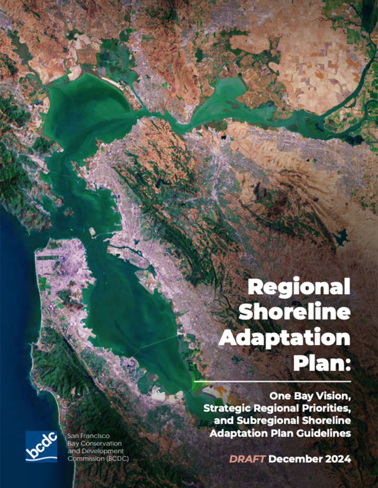
The major development since last year’s meeting was the December release of theRegional Shoreline Adaptation Planby the San Francisco Bay Conservation and Development Commission. BCDC is a state organization that has control over the inner Bay coastline and nearby wetlands. In 2023, the state Legislature enactedSenate Bill 272, which mandates that Bay shore governments create and submit a shoreline resiliency plan to the BCDC by 2034.
The December report presented a comprehensive regional outlook. It also includes recommendations that local authorities are required to adhere to when creating their strategies. As stated in the report, the projected cost of implementing sea level rise adaptation initiatives by 2050 is approximately $110 billion across the entire Bay Area, whereas the expense of taking no action is expected to reach $230 billion in damages.
To prepare their plans, city councils have been releasing requests for proposals and seeking out civil engineers, landscape architects, and community involvement organizations.
We’ve already engaged in discussions with 75% of the required jurisdictions to develop a plan,” stated Dana Brechwald, assistant planning director for climate adaptation at BCDC. “We are approving various projects, such as wetland habitat restoration that expands the Bay’s surface area by approximately 394 acres, along with 3 miles of public access trails and almost 7 acres of open space.
Funds shift following federal reductions
The need to make America’s infrastructure more resistant to climate change became urgent in 2021. That was when the former President Joe Biden’s administration enacted theBipartisan Infrastructure LawIt increased the federal financial support provided to communities to enhance their readiness for hurricanes, floods, and other natural catastrophes.
The law expanded the Creating Strong and Sustainable Infrastructure and Communitiesa funding initiative that covered between 75% and 90% of the expenses for constructing climate-related hazard reduction projects. The legislation introduced a new guideline aimed at fostering fairness by ensuring that 40% of the advantages went to underprivileged communities.
Everything was lost during the Trump administration. In April, the Federal Emergency Management Agency ended the BRIC program, halted all funded BRIC grants that weren’t already being built, and requested the return of unused funds from the initiative. The reductions are being challenged in court by 20 states, including California, as reported.a trackerfrom the Environmental and Energy Law Program at Harvard University.

New methods for funding were examined during a packed breakout session at the Monday summit. Panelist Len Materman from San Mateo County’s OneShoreline special district proposed linking sea level adaptation initiatives with pressing concerns such as housing, a countywide property tax calculated by square footage per structure to ensure large companies pay more, or requiring cities to have developers finance infrastructure upgrades that align with current urban plans.
Entrepreneur Zach Knight from Blue Forest employs projection models to determine the financial impact of climate change on utility companies and contrasts this with the cost of preventive infrastructure initiatives such as forest management, redefining corporate investment as a means of reducing expenses.
Additional financial options are offered by the state. Planning grants can be accessed by local, regional, and tribal governments through theSenate Bill 1 Grant Program for Planning Adaptation to Rising Sea Levels. Proposition 4, a funding initiative approved by voters in November, is projected to raise approximately $10 billion across the state for numerous climate adaptation, water, and natural resource management programs, as reported by the Public Policy Institute of California.
Last week, the Legislature approved extending the state’s cap-and-trade system until 2045. It was originally scheduled to end in 2030. With the cap-and-trade system, companies are required to cut their emissions, purchase permits from the state or other companies, or support initiatives designed to balance out their emissions. The funds collected by the state from these sales are used to support efforts against climate change, affordable housing and transportation initiatives, and utility bill credits for residents of California.
Resilience meets displacement risks
Floods that occur seasonally are common in the Bay Area, particularly in neighborhoods built on land that has been filled in, which tends to sink and compact over time. The combination of sinking ground and rising ocean levels creates a serious situation during a period of more severe storms, increasing the likelihood of people being forced to leave their homes. However, constructing new facilities, such as green coastal parks, can increase the worth of less valuable land and result in displacement due to gentrification.
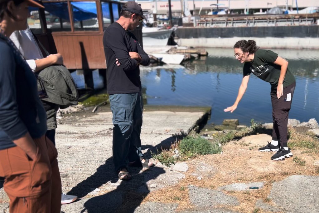
The situation was observed during Sunday’s walking tour of the filled-in Canal area in San Rafael. The tour was led by Carly Finkle, senior policy manager at the Canal Alliance, a nonprofit organization that supports the neighborhood’s vulnerable Latino population. Finkle explained that the land has sunk into a bowl-like formation, with stacks of rocks and self-built seawalls dividing the below-sea-level community from San Pablo Bay.
“If a large volume of water entered due to waves overflowing during a severe storm or an earthquake that damaged the informal barriers preventing water from entering, the quantity of water that could accumulate in the area would be so substantial that buildings would have to be torn down and reconstructed,” said Finkle.
The conditions in the canal represent a hidden disaster that could occur at any moment. There might be 4 to 6 feet of water in certain areas of the community. This isn’t a type of catastrophe that develops slowly over time. I understand that it usually takes an emergency to get people’s attention, but I believe the current situation is extremely challenging,” she stated.
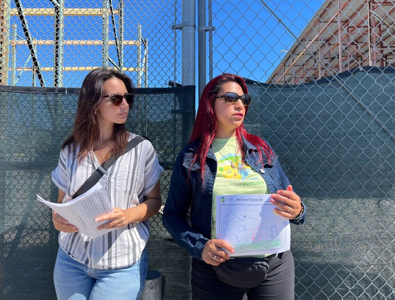
Resident Irene de Leon from Nuestro Canal, Nuestro Futuro Consejo de Residentes (Our Canal, Our Future resident advisory committee) addressed the tour group, discussing the challenges of residing in the highly populated rental community and presented children’s artwork depicting their aspirations for a proposed public area.
One of the individuals in the tour group was John Gibbs from WRT Planning and Design. His company is set to collaborate with San Rafael on a targeted plan for the Canal district, which will involve urban design and measures to prevent displacement.
I’m optimistic that the clarity these residents have about their story can be a crucial element and a chance for financial support,” Gibbs stated. “How do you provide funding and implement policies that recognize the community as a central financial consideration?
For additional details, the BCDC’s Regional Shoreline Adaptation Plan is available athttps://tinyurl.com/yc6p5asf.
The post The Bay Adapt Summit unites leaders to explore coastal planning in the face of federal budget reductions. appeared first on Local News Matters.