Hurricane Imelda and Humberto: A Rare Atlantic Showdown
Hurricane Imelda is expected to make its way toward Bermuda on Wednesday night, just a day after Hurricane Humberto passed by the islands. Both storms are anticipated to bring high surf, rip currents, and some coastal flooding along parts of the East Coast this week.
Hurricane Humberto’s Impact on Bermuda
Humberto, currently located about 275 miles northwest of Bermuda, has lost some of its strength due to wind shear, partly influenced by nearby Hurricane Imelda. Although the core of Humberto’s strongest winds will likely miss Bermuda, heavy rainbands and gusty winds are still expected there through Wednesday.
After Wednesday, Humberto is projected to move into the open North Atlantic, where it will merge with a cold front.
Hurricane Imelda’s Approach to Bermuda
Imelda has shifted eastward toward Bermuda, where it is expected to pass as a Category 1 or 2 hurricane on Wednesday. A hurricane warning is in effect for Bermuda, indicating that hurricane-force conditions are expected by Wednesday evening. Winds of over 40 mph may begin as early as Wednesday afternoon.
Bermuda could also experience additional rainfall from Imelda, with 2 to 4 inches of rain expected following the outer bands from Humberto. Storm surge flooding is also anticipated, adding to the high surf already generated by Humberto.
Imelda will then move into the North Atlantic on Thursday, transitioning into a non-tropical low.
U.S. Impacts from the Hurricanes
Although Imelda is well offshore and moving away from the Southeast coast, significant rainfall flooding or wind impacts are not expected in the U.S. The primary effects from both Humberto and Imelda will be dangerous high surf, rip currents, and minor to locally moderate flooding at high tide.
Several homes have already fallen into the Atlantic in Buxton, North Carolina. The threat of rip currents will persist over the next few days, stretching from coastal New England to Florida’s Atlantic beaches.
The most concerning period for coastal flooding in the U.S. will be late Wednesday afternoon, from the Jersey Shore to the coastal Carolinas. It is crucial to obey any beach alerts and avoid the surf zone if in doubt.
Unusually Close Hurricanes in the Atlantic Basin
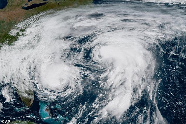
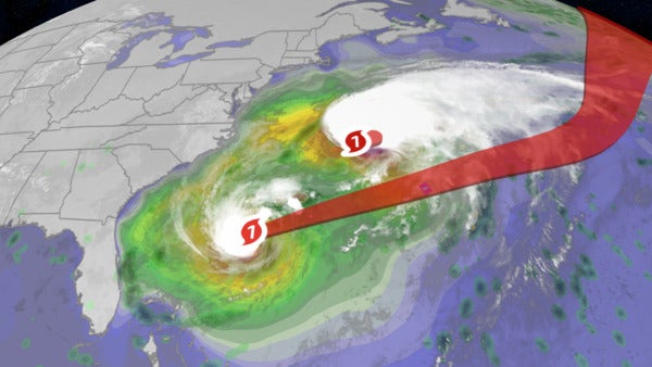
The proximity of two hurricanes in the Atlantic Basin has drawn attention from meteorologists. As of Tuesday, the centers of Humberto and Imelda were less than 500 miles apart, marking the closest any two Atlantic Basin hurricanes have been in at least 59 years, according to WPLG-TV hurricane expert Michael Lowry.
Upper-level outflow winds from Imelda increased wind shear over Humberto, as shown in a satellite loop posted on X by NOAA/CIRA. This interaction between two tropical systems is known as the Fujiwhara effect, which in this case helped prevent Imelda from making landfall in the Southeast by pulling it east instead.
Recap of the Hurricanes’ Journey
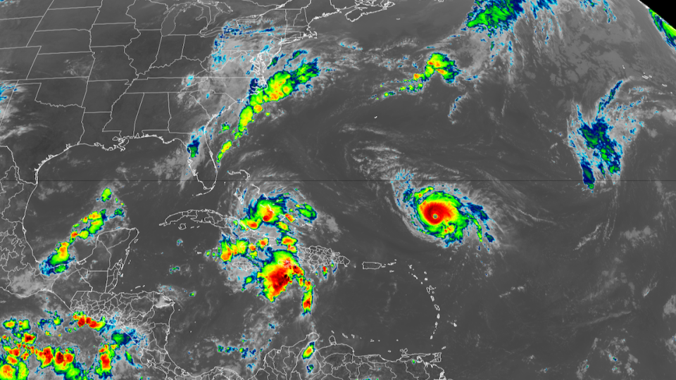
Humberto and Imelda originated off Africa in mid-September, slowly traveling across the Main Development Region for a week before Tropical Storm Humberto formed on September 24, several hundred miles east of the Leeward Islands.
By the 24th and 25th, the tropical wave that eventually became Imelda brought widespread rainfall of 1 to 4 inches across Puerto Rico, with the heaviest totals in the southern parts of the territory. This led to flood and landslide reports, including one incident where a car was washed out with people still inside. At least one person was killed.
As Humberto formed to the northeast, the wave that would become Imelda spread rain to Hispaniola. One person was killed and 5,000 homes flooded in southwestern Haiti. Landslides and river flooding affected the Dominican Republic, where a bridge collapsed, killing a driver in Yamasá.

By September 26, Humberto had become a hurricane well to the northeast of Puerto Rico, while pre-Imelda moved its rains over Cuba and the Bahamas. Flooding and landslides were reported in Cuba, with two fatalities.
The forecast for Imelda became extremely uncertain that day, with models pointing to different paths, including the Carolinas or out to sea. For more details on this forecast challenge, see the next section.
As Imelda moved through the Bahamas, peak wind gusts reached 44 mph in Nassau and 38 mph in Freeport. Over 2 inches of rain was recorded at Over Yonder Cay, halfway between Nassau and Exuma.
Humberto underwent rapid intensification last Friday, with its maximum sustained winds increasing from 65 to 145 mph in 24 hours. It then became the second Category 5 hurricane in the Atlantic Basin this season.
Forecast Challenges for Imelda
The forecast for the system that became Imelda was highly uncertain. Three distinct model camps emerged: one predicting a landfall in the Carolinas, another expecting the storm to stall off the Southeast coast, and a third projecting it to move out to sea.
At the extremes of this uncertainty were an unseasonably far south upper-level low and the Bermuda High. In between, both Imelda and Humberto were set to travel a narrow gap. Models needed to accurately predict the strength and position of all four features and their interactions.
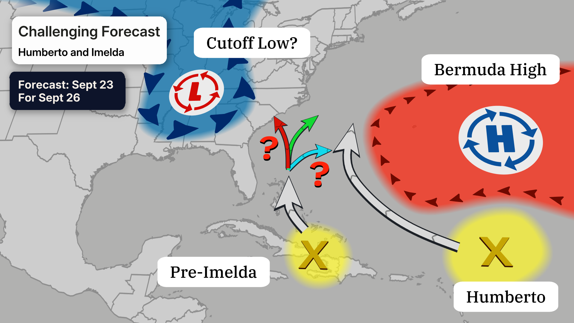
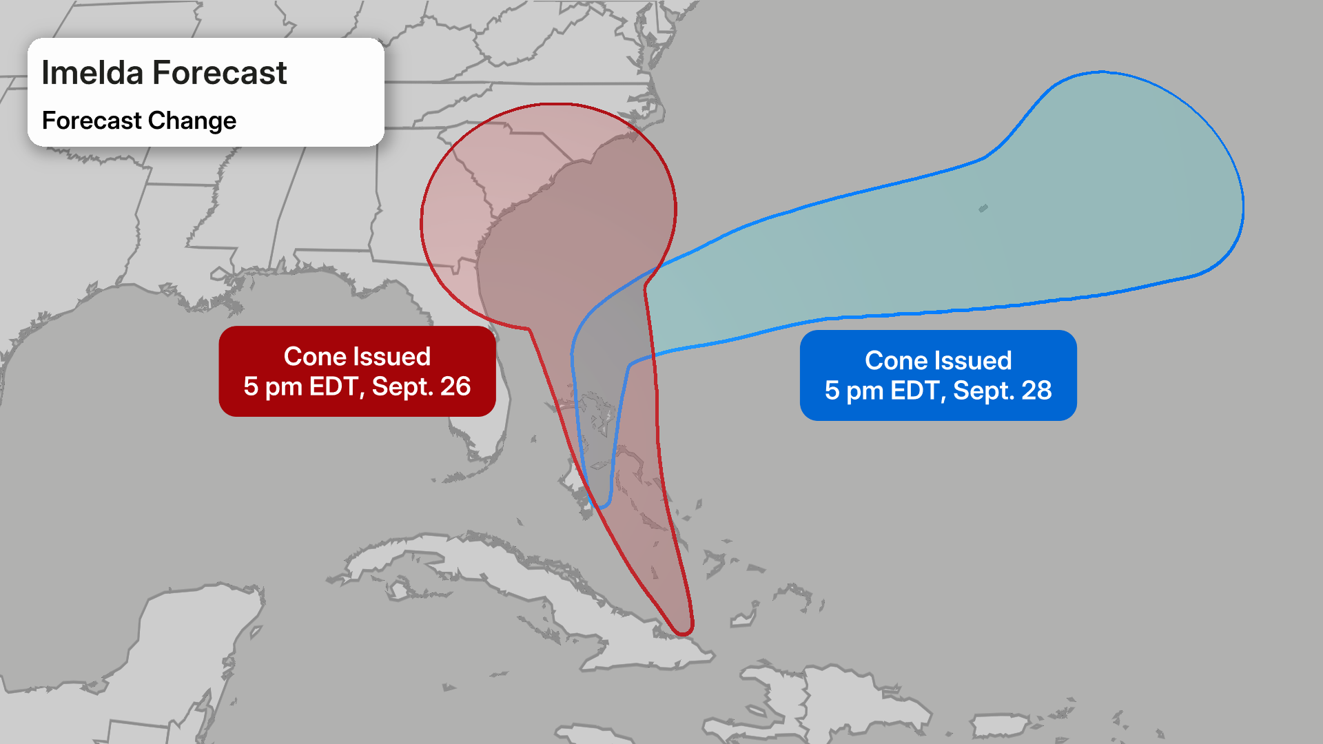
In just 48 hours, from late September 26 — when the first cone of uncertainty was issued — to the evening of September 28, the NHC forecast changed significantly, shifting from a potential landfalling hurricane in the Southeast to a hard east turn before reaching the coast, as shown in the graphic below.
(More:
How Imelda’s Forecast Changed)
It turned out that Imelda’s slower northward progress, a weaker upper-level low, and a stronger-than-expected Humberto made a big difference in Imelda’s track. Humberto’s strength allowed it to help break down the Bermuda High, steering Imelda eastward.
The impact between the two storms was not one-sided. There was also a subtle change in Humberto’s intensity because Imelda’s close proximity caused a taxing upper-level northwest wind, leading to Humberto’s weakening.