Development of Tropical Storm Imelda
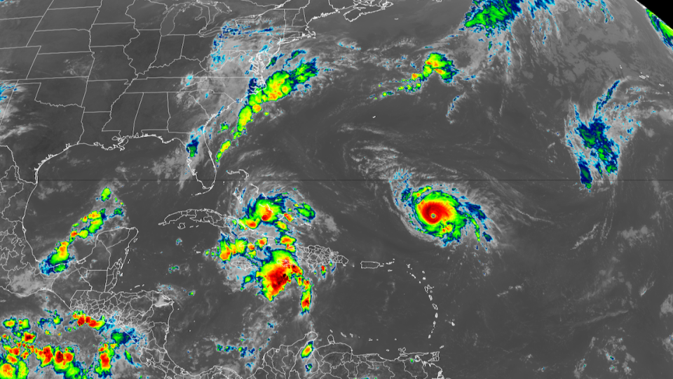
Tropical Storm Imelda is showing signs of becoming a more organized tropical cyclone, according to recent data from the National Oceanic and Atmospheric Administration and Air Force Reserve hurricane hunters. While wind speeds are currently around 60 mph, satellite images indicate a central dense overcast, suggesting that the storm’s strongest clouds are beginning to form over its center. This development signals that Imelda is forming an inner core and is expected to strengthen further in the coming days.
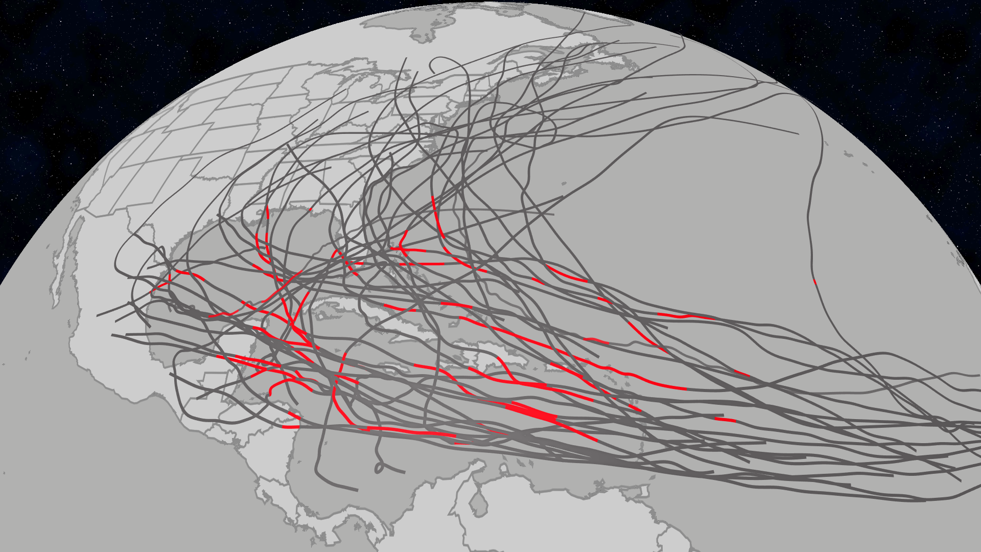
The storm’s path is being closely monitored by forecasters, with spaghetti models indicating a potential northwest trajectory toward the Carolinas or a northeasterly direction toward Bermuda. However, the National Hurricane Center (NHC) suggests that Hurricane Humberto will influence Imelda’s movement, causing it to shift abruptly east-northeastward as it accelerates.
Potential Impact on Florida
Imelda, along with another non-tropical disturbance, is expected to bring heavy rainfall to Atlantic coastal areas from Florida to North Carolina and southern Virginia. While the greatest risks are anticipated north of Florida, including the Carolinas and Georgia’s eastern coast, some flooding and damaging winds could affect the tips of Florida’s eastern coastline.
Intensity Forecast for Imelda
Imelda is predicted to continue intensifying over the next few days, potentially reaching hurricane status by Tuesday morning. However, several factors may limit its strength. Tail Doppler Radar indicates a modest tilt north, which could slow its intensification. Additionally, the circulation from Humberto and cooler waters left in its wake may disrupt Imelda’s organization.
According to forecasts, Imelda is expected to peak as a Category 2 hurricane with wind speeds of around 100 mph overnight on Thursday. Weakening is anticipated later in the week, with Imelda likely transitioning to post-tropical cyclone status by the weekend.
Current Status of Imelda
At 4 p.m. ET, the center of Tropical Storm Imelda was located near latitude 27.7 North, longitude 77.3 West. The storm is moving north at about 9 mph, with a general northward motion expected through Tuesday night. On Tuesday, Imelda is forecast to turn sharply to the east-northeast and accelerate. The system is expected to move away from the northwestern Bahamas this afternoon and then head east-northeastward, approaching Bermuda on Wednesday.
Maximum sustained winds have increased to near 65 mph, with higher gusts. Additional strengthening is expected over the next few days, and Imelda is forecast to become a hurricane on Tuesday morning.
Warnings and Watches
A Hurricane Watch is in effect for Bermuda, while a Tropical Storm Warning is active for the extreme northwestern Bahamas, including Great Abaco, Grand Bahama Island, and the surrounding keys. A Hurricane Watch means that hurricane conditions are possible within the watch area, typically issued 48 hours before the anticipated first occurrence of tropical-storm-force winds. A Tropical Storm Warning indicates that tropical storm conditions are expected within the warning area within 12 hours.
Interests in Bermuda should monitor the progress of Imelda, as Hurricane watches could be required for the island as early as this afternoon. For specific storm information, individuals should consult products issued by their national meteorological service.
Weather Conditions
WIND: Hurricane conditions are possible within the watch area by Wednesday night, with tropical storm conditions expected by Wednesday afternoon. Tropical storm conditions are already occurring in portions of the extreme northwestern Bahamas and will continue through tonight.
RAINFALL: Imelda is expected to produce additional rainfall of 1 to 3 inches across the northwest Bahamas through tonight, which may lead to flash and urban flooding. In northeast Florida, coastal South Carolina, and coastal sections of southeast North Carolina, 1 to 2 inches of rainfall with local maxima of 4 inches are expected. As Imelda passes near Bermuda, 2 to 4 inches of rainfall is anticipated from Wednesday into Thursday.
STORM SURGE: A storm surge could raise water levels by up to 1 to 3 feet above ground level along the immediate coast in areas of onshore winds in the northwestern Bahamas. Minor coastal flooding is possible in areas of onshore winds along the Southeastern U.S. coastline.
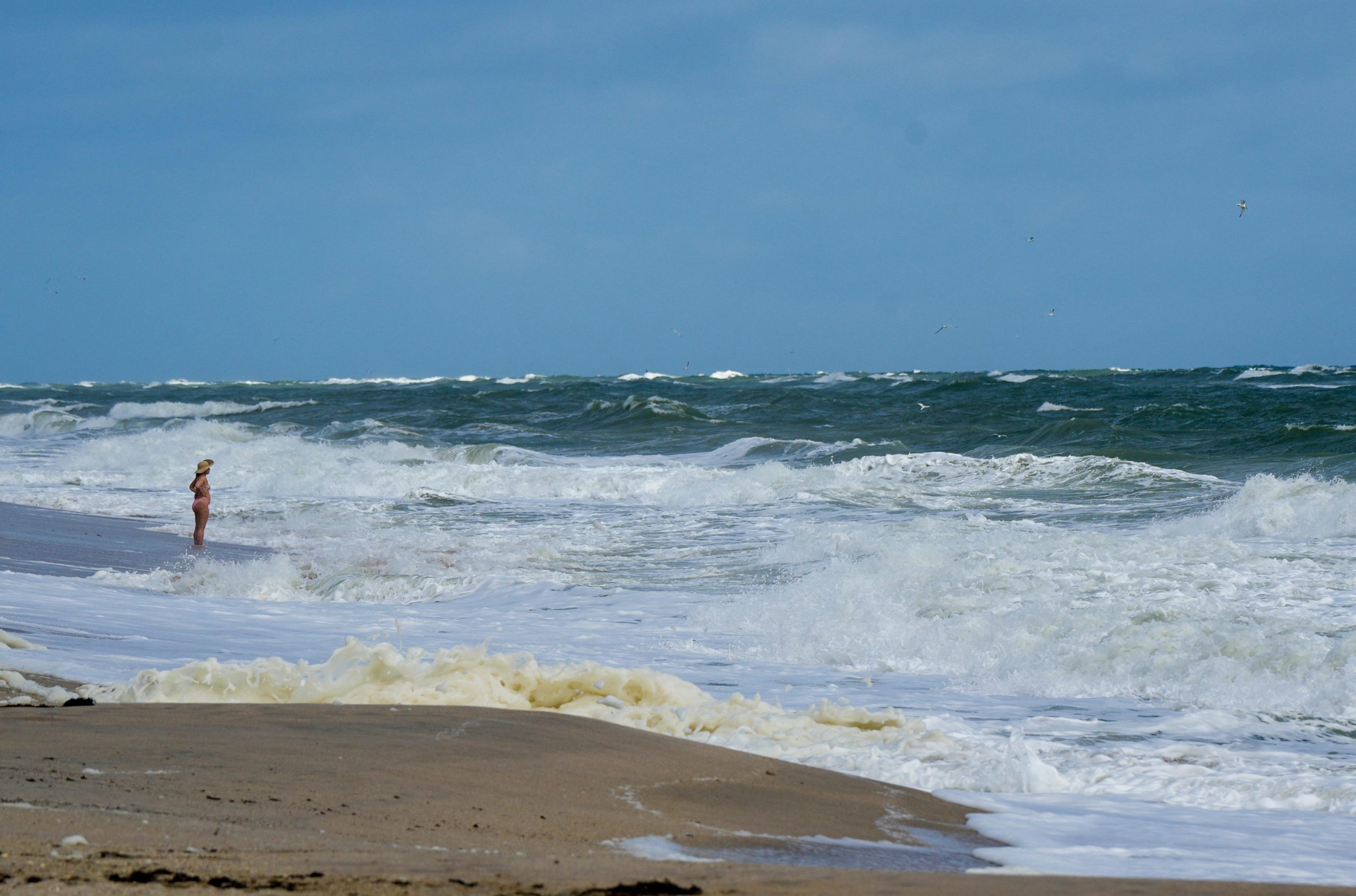
SURF: Swells from Humberto are likely to cause dangerous surf and life-threatening rip current conditions, affecting beaches in the northern Caribbean, Bahamas, Bermuda, and much of the east coast of the United States over the next several days.
Spaghetti Models and Updates
The NHC has updated its advisory with the latest information on Imelda, including details on its movement and potential impacts. These models provide critical insights into the storm’s path and intensity, helping authorities and residents prepare for potential effects.